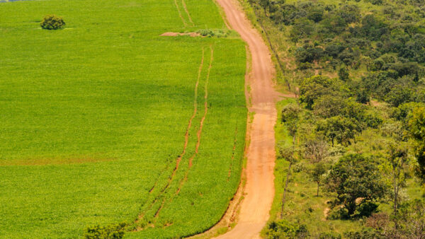
Over the past 11 years, Brazil’s agricultural production has experienced a major leap, as proven by the 2017 agricultural census. The area of newly cultivated land is equivalent of the territories of Portugal, Belgium, and Denmark – combined. But this growth has by no means been equal across all states. Pará in the North and Mato Grosso in the Center-West registered the biggest growth in cultivated areas.
While the portion of Brazilian land dominated by agricultural establishments has grown by 5 percent since 2006, 77 percent of that growth has been in Pará and Mato Grosso alone.
Data for the agricultural census is collected in the same way the government uses for a traditional population census, with surveyors visiting each property in turn. Therefore, the data compiled is self-declared and not cross-checked with satellite imagery.
As the data is not directly comparable to images from space, there is no way to find out precisely where this expansion has happened. It could have been in previously unused areas of the property, such as a landing strip, or it could be on areas which were previously protected. Pará, for example, was the leader in deforestation between 2006 and 2017, with roughly 4 million hectares of the Amazon rainforest being cut down.
The next in the ranking? Mato Grosso – with an additional 2 million hectares of deforestation. Mato Grosso also lost 1.8 hectares of the cerrado, a savannah-like biome.
Meanwhile, the Northeast region has seen the opposite trend.
Chastised by a severe five-year drought (which now threatens the Center-West and Southeast), the Northeast saw its “agricultural borders” shrink by 9.9 hectares as of 2006, when the last agricultural census was carried out. “There’s a massive area between Bahia and Rio Grande do Norte that has experienced desertification. A lot of producers have left those lands,” says census coordinator, Antonio Florido.
We have selected the best charts to explain how Brazil’s agribusiness production is spread across the country. To explore these charts interactively, click here.

Brazil’s soybean country

Where corn is the leading crop

Where coffee is the leading crop

Center-West
Mato Grosso

Mato Grosso do Sul

Goiás

Distrito Federal

North
Pará

Acre

Amapá

Amazonas

Roraima

Rondônia

Tocantins

Southeast
São Paulo

Minas Gerais

Rio de Janeiro

Espírito Santo

South
Rio Grande do Sul

Santa Catarina

Paraná

Northeast
Bahia

Pernambuco

Alagoas

Sergipe

Ceará


 Search